Explore
Every journey we run or plan to run, from a first 6,000 metre summit to the eight thousanders, and the trekking routes that lead to them.
Expeditions
8000ers
6000ers
Ama Dablam
Ama Dablam and Lobuche East
Ama Dablam and Island Peak
Three Peaks and Everest Base Camp
Lobuche East, Island Peak and Everest Base Camp
Lobuche East and Everest Base Camp
Lobuche East
Island Peak and Everest Base Camp
Island Peak
Mera Peak
Mera Peak and Island Peak
Cholatse
Chulu West
Pharchamo via Tashi Lapcha
Dhampus Peak
Trekking
Manaslu
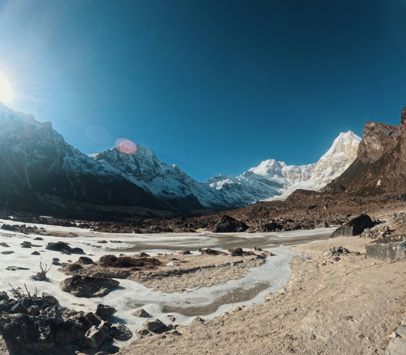
Langtang
Ladakh
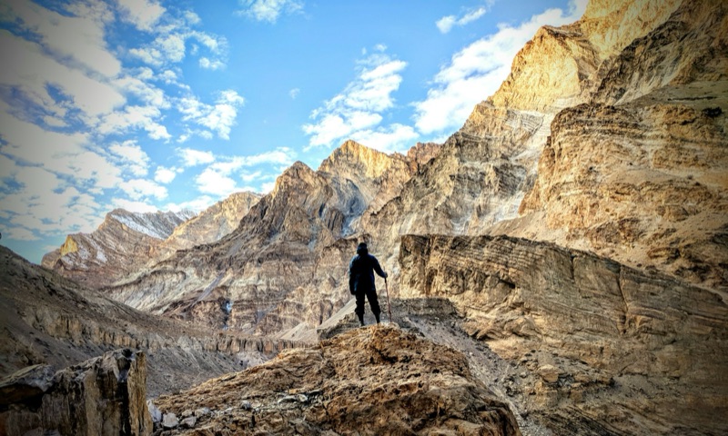
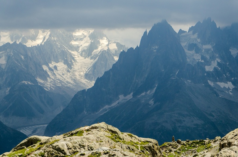
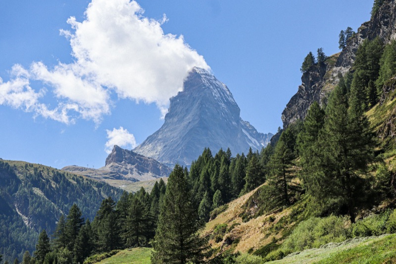
South America
Africa
Everest
Elevation
8,848 m
Region
Khumbu
Country
Nepal
Full route notes are being written. Groups form when demand and partnerships align. Join the interest list and you’ll hear first.
Groups form each season. Join the interest list and you’ll hear first.
Join the GroupK2
Elevation
8,611 m
Region
Karakoram
Country
Pakistan
Full route notes are being written. Groups form when demand and partnerships align. Join the interest list and you’ll hear first.
Groups form each season. Join the interest list and you’ll hear first.
Join the GroupKangchenjunga
Elevation
8,586 m
Region
Kangchenjunga
Country
Nepal
Full route notes are being written. Groups form when demand and partnerships align. Join the interest list and you’ll hear first.
Groups form each season. Join the interest list and you’ll hear first.
Join the GroupLhotse
Elevation
8,516 m
Region
Khumbu
Country
Nepal
Full route notes are being written. Groups form when demand and partnerships align. Join the interest list and you’ll hear first.
Groups form each season. Join the interest list and you’ll hear first.
Join the GroupMakalu
Elevation
8,485 m
Region
Makalu Barun
Country
Nepal
Full route notes are being written. Groups form when demand and partnerships align. Join the interest list and you’ll hear first.
Groups form each season. Join the interest list and you’ll hear first.
Join the GroupCho Oyu
Elevation
8,188 m
Region
Khumbu
Country
Nepal
Full route notes are being written. Groups form when demand and partnerships align. Join the interest list and you’ll hear first.
Groups form each season. Join the interest list and you’ll hear first.
Join the GroupDhaulagiri I
Elevation
8,167 m
Region
Dhaulagiri
Country
Nepal
Full route notes are being written. Groups form when demand and partnerships align. Join the interest list and you’ll hear first.
Groups form each season. Join the interest list and you’ll hear first.
Join the GroupManaslu
Elevation
8,163 m
Region
Manaslu
Country
Nepal
Full route notes are being written. Groups form when demand and partnerships align. Join the interest list and you’ll hear first.
Groups form each season. Join the interest list and you’ll hear first.
Join the GroupNanga Parbat
Elevation
8,125 m
Region
Himalaya
Country
Pakistan
Full route notes are being written. Groups form when demand and partnerships align. Join the interest list and you’ll hear first.
Groups form each season. Join the interest list and you’ll hear first.
Join the GroupAnnapurna I
Elevation
8,091 m
Region
Annapurna
Country
Nepal
Full route notes are being written. Groups form when demand and partnerships align. Join the interest list and you’ll hear first.
Groups form each season. Join the interest list and you’ll hear first.
Join the GroupGasherbrum I
Elevation
8,080 m
Region
Karakoram
Country
Pakistan
Full route notes are being written. Groups form when demand and partnerships align. Join the interest list and you’ll hear first.
Groups form each season. Join the interest list and you’ll hear first.
Join the GroupBroad Peak
Elevation
8,051 m
Region
Karakoram
Country
Pakistan
Full route notes are being written. Groups form when demand and partnerships align. Join the interest list and you’ll hear first.
Groups form each season. Join the interest list and you’ll hear first.
Join the GroupGasherbrum II
Elevation
8,034 m
Region
Karakoram
Country
Pakistan
Full route notes are being written. Groups form when demand and partnerships align. Join the interest list and you’ll hear first.
Groups form each season. Join the interest list and you’ll hear first.
Join the GroupShisha Pangma
Elevation
8,027 m
Region
Tibet
Country
China
Full route notes are being written. Groups form when demand and partnerships align. Join the interest list and you’ll hear first.
Groups form each season. Join the interest list and you’ll hear first.
Join the GroupHimlung Himal
Elevation
7,126 m
Region
Manaslu
Country
Nepal
Full route notes are being written. Groups form when demand and partnerships align. Join the interest list and you’ll hear first.
Groups form each season. Join the interest list and you’ll hear first.
Join the GroupBaruntse
Elevation
7,129 m
Region
Khumbu
Country
Nepal
Full route notes are being written. Groups form when demand and partnerships align. Join the interest list and you’ll hear first.
Groups form each season. Join the interest list and you’ll hear first.
Join the GroupBaruntse and Mera Peak
Elevation
7,129 m
Region
Khumbu
Country
Nepal
Full route notes are being written. Groups form when demand and partnerships align. Join the interest list and you’ll hear first.
Groups form each season. Join the interest list and you’ll hear first.
Join the GroupPutha Hiunchuli
Elevation
7,246 m
Region
Dhaulagiri
Country
Nepal
Full route notes are being written. Groups form when demand and partnerships align. Join the interest list and you’ll hear first.
Groups form each season. Join the interest list and you’ll hear first.
Join the GroupPumori
Elevation
7,145 m
Region
Khumbu
Country
Nepal
Full route notes are being written. Groups form when demand and partnerships align. Join the interest list and you’ll hear first.
Groups form each season. Join the interest list and you’ll hear first.
Join the GroupNuptse
Elevation
7,864 m
Region
Khumbu
Country
Nepal
Full route notes are being written. Groups form when demand and partnerships align. Join the interest list and you’ll hear first.
Groups form each season. Join the interest list and you’ll hear first.
Join the GroupAnnapurna IV
Elevation
7,525 m
Region
Annapurna
Country
Nepal
Full route notes are being written. Groups form when demand and partnerships align. Join the interest list and you’ll hear first.
Groups form each season. Join the interest list and you’ll hear first.
Join the GroupAma Dablam
Duration
25 days
Max altitude
6,812 m (summit)
Difficulty
Severe
Best season
Oct–Nov & Apr–May
Region
Khumbu, Nepal
The journey
The most beautiful mountain in the Khumbu, and one of the world’s great technical expedition climbs. Three weeks on the southwest ridge: granite, ice and the famous hanging glacier that gives the mountain its name.
Know before you dream
- A full expedition, not a trekking peak: government expedition permit, established camps, weeks on the mountain.
- The southwest ridge is sustained technical climbing: rock to 5.7, steep ice, wildly exposed ridgeline between Camps 1 and 2.
- Prerequisites are firm: 6,000er summits, fixed-line fluency, real rock and ice technique at altitude.
- Camp 2 sits on a granite tower the size of a dinner table row; this mountain’s exposure is famous for a reason.
- Autumn is the classic season; the route becomes a small vertical village of teams sharing fixed lines.
Route
Highlights
- The Dablam itself, the hanging glacier under the summit ice
- Camp 2 on its granite perch, the most photographed campsite in the Himalaya
- The Yellow Tower, the ridge’s defining rock pitch
- Everest and Lhotse across the valley from the summit
- The mountain every Khumbu trekker photographs, climbed
Gear and preparation
Full expedition technical kit; the list is long and specific, covered in Know the Mountain and in conversation before anyone commits.
Questions
How hard truly?
The hardest widely-climbed 6,000er in Nepal; alpine rock and ice at altitude for days.
Ready how?
Mera or Island, then Lobuche, then a technical peak, then this. We help map the path.
Duration why?
Acclimatisation rotations and weather windows; expeditions move at the mountain’s pace.
Solo joiners?
Expeditions build the team; arriving alone is normal.
Groups form each season. Join the interest list and you’ll hear first.
Join the GroupAma Dablam and Lobuche East
Duration
28 days
Max altitude
6,812 m (Ama Dablam)
Difficulty
Severe
Best season
Oct–Nov
Region
Khumbu, Nepal
The journey
The warm-up and the masterpiece. Lobuche East’s fixed lines as an acclimatising rehearsal, then the full southwest-ridge expedition on the most beautiful mountain in the Khumbu.
Know before you dream
- Lobuche here is not a trophy; it is a shakedown: gear, systems, and altitude tested where the consequences are smaller.
- The Ama Dablam prerequisites do not soften because of the pairing: this is for climbers already fluent on fixed lines and steep ground.
- Four weeks on one itinerary; expedition patience is the fifth piece of gear.
- Autumn only: this pairing follows Ama Dablam’s classic season.
- Full expedition permit stack; insurance covering technical climbing to 7,000 m.
Route
Highlights
- Everest at eye level from Lobuche, then framed by the Dablam three weeks later
- Systems rehearsed low, executed high
- Camp 2’s granite perch with a rehearsed body
- Two summits with one arc of fitness
- The Khumbu’s complete climbing education in one line
Gear and preparation
Full expedition technical kit throughout; the Lobuche leg doubles as its live test. Detailed in conversation and Know the Mountain.
Questions
Why pair them?
The rehearsal effect: teams that warm up on Lobuche move better on the ridge.
Could I skip Lobuche?
The mountain will notice even if the schedule doesn’t.
Success factors?
Weather windows and rope discipline, in that order.
Solo joiners?
Expeditions build the team.
Groups form each season. Join the interest list and you’ll hear first.
Join the GroupAma Dablam and Island Peak
Duration
27 days
Max altitude
6,812 m (Ama Dablam)
Difficulty
Severe
Best season
Oct–Nov
Region
Khumbu, Nepal
The journey
The same logic, gentler rehearsal: Island Peak’s glacier and headwall to tune altitude and systems, then the southwest ridge of Ama Dablam.
Know before you dream
- Island’s headwall rehearses jumar work; Ama Dablam’s ridge demands it for days: the pairing is a staircase, not a repetition.
- Prerequisites remain firm: this suits climbers whose technique is proven and whose altitude base needs waking, not building.
- Expedition rhythm rules the second half: rotations, waiting, the summit when the mountain says so.
- Autumn season, shared fixed lines, a small vertical community on the ridge.
- Expedition permits and technical insurance throughout.
Route
Highlights
- The headwall at dawn as rehearsal, the Yellow Tower as the exam
- Imja valley first, Mingbo valley after
- An acclimatisation curve spent on the Khumbu’s finest line
- Camp 1 nights with the route above catching last light
- Two ridges, one season, one story
Gear and preparation
Full expedition technical kit; Island doubles as shakedown. Detailed in conversation and Know the Mountain.
Questions
Island or Lobuche as the warm-up?
Island wakes altitude on gentler ground; Lobuche rehearses steepness harder. Choose by your gap.
How long on Ama Dablam itself?
Around three weeks of the itinerary.
Realistic first expedition?
Only with the prerequisites genuinely met.
Solo joiners?
The team forms on the mountain.
Groups form each season. Join the interest list and you’ll hear first.
Join the GroupThree Peaks and Everest Base Camp
Duration
28 days
Max altitude
6,476 m (Mera Peak)
Difficulty
Severe
Best season
Apr–May & Oct–Nov
Region
Khumbu & Hinku, Nepal
The journey
The complete collection. The Hinku’s high glacier summit, a crossing of the Amphu Laptsa, then the Khumbu’s two classic peaks and Base Camp: a month that compresses years of progression.
Know before you dream
- This is a mountaineering programme, not a holiday: four weeks, three summits, one 5,845 m technical pass between valleys.
- The Amphu Laptsa crossing is expedition terrain: abseils, load management, no teahouse for days.
- Weather will take something from the plan somewhere; the itinerary holds slack and the leaders hold judgement.
- Entry requires prior altitude experience; this is a poor place to discover your limits for the first time.
- The full permit stack across two valleys; insurance vetted line by line.
Route
Highlights
- Mera’s five-8,000er panorama as the opening act
- The Amphu Laptsa, a wild pass few trekkers ever see
- Island and Lobuche with a month’s acclimatisation behind them
- The Hinku’s emptiness and the Khumbu’s grandeur in one line
- The most complete journey we run below 7,000 m
Gear and preparation
Full expedition kit; the pass adds abseil loads and glacier camping. Serious list in Know the Mountain.
Questions
Who is this for?
Climbers building deliberately toward bigger mountains.
Hardest moment?
Usually the pass, not the summits.
Can I join for part?
The line doesn’t split well; the shorter combinations exist for that.
Solo joiners?
The team forms around the objective.
Groups form each season. Join the interest list and you’ll hear first.
Join the GroupLobuche East, Island Peak and Everest Base Camp
Duration
23 days
Max altitude
6,189 m (Island Peak)
Difficulty
Severe
Best season
Apr–May & Oct–Nov
Region
Khumbu, Nepal
The journey
The full Khumbu apprenticeship. Base Camp, then Lobuche East, then Island Peak: one acclimatisation curve spent on two different kinds of climbing.
Know before you dream
- The order is deliberate: Lobuche’s sustained lines first, Island’s headwall second, each summit making the next more likely.
- Three weeks at altitude asks for genuine endurance; recovery days are built in and respected.
- Two summits double the weather exposure; flexibility is part of the plan, and one summit is a success.
- This is the strongest preparation this valley offers for 7,000 m ambitions.
- Full permit stack; insurance covering repeated climbs to 6,500 m.
Route
Highlights
- Two summit dawns in one journey
- Everest from Kala Patthar, then twice from above
- The skills compounding: what Lobuche teaches, Island confirms
- Three weeks of Khumbu light
- Coming home a different climber than you left
Gear and preparation
The complete Khumbu climbing kit, used hard. Full guidance in Know the Mountain.
Questions
Both summits guaranteed?
Nothing at altitude is; the itinerary gives both an honest chance.
Fitness bar?
The highest of our Khumbu programmes.
Why this order?
Sustained technique first, steep crux second, fatigue managed.
Solo joiners?
Most of the rope team.
Groups form each season. Join the interest list and you’ll hear first.
Join the GroupLobuche East and Everest Base Camp
Duration
18 days
Max altitude
6,119 m (Lobuche East)
Difficulty
Severe
Best season
Apr–May & Oct–Nov
Region
Khumbu, Nepal
The journey
Base Camp first, then the quiet mountain above it. The EBC pilgrimage builds the base; Lobuche East’s fixed lines spend it, with Everest at eye level from the summit.
Know before you dream
- Lobuche’s climbing is more sustained than Island’s; the combination suits second-summit climbers or well-prepared, well-trained first-timers.
- High camp sits barely off the EBC trail; the transition from trek to climb happens in an afternoon.
- Summit day is 10 to 12 hours; the EBC legs in your body are the entry fee, the reserve is the skill.
- Descent discipline decides how this trip is remembered.
- Permit stack as with all Khumbu climbs.
Route
Highlights
- Kala Patthar sunrise, then a real summit three days later
- Everest, Nuptse and Lhotse from a ridge you earned
- Slab climbing above the glacier you walked beside
- The crowds of the trail, then a base camp of one team
- Two Khumbus in one journey: the famous and the quiet
Gear and preparation
EBC kit plus the full Lobuche climbing set. Details in Know the Mountain.
Questions
This or Island+EBC?
This is the steeper, quieter version of the same idea.
Fitness bar?
The trek’s endurance plus a 12-hour climbing day.
Best season?
Both windows work; autumn views, spring warmth.
Solo joiners?
Most of the rope team.
Groups form each season. Join the interest list and you’ll hear first.
Join the GroupLobuche East
Duration
14 days
Max altitude
6,119 m (summit)
Difficulty
Severe
Best season
Apr–May & Oct–Nov
Region
Khumbu, Nepal
The journey
The connoisseur’s Khumbu summit. Steeper and quieter than Island Peak, rising directly above the EBC trail with a summit-day view that puts Everest at eye level across the valley.
Know before you dream
- The most sustained climbing of the classic trekking peaks: long fixed-line sections on snow and rock slabs up to 45 degrees.
- Prior crampon time helps here; as a first summit it is a serious choice.
- The route shares the EBC trail’s acclimatisation, then leaves the crowds entirely at base camp.
- Summit day runs 10 to 12 hours; the descent on tired legs is where discipline shows.
- Association permit via agency; insurance to 6,500 m including climbing.
Route
Highlights
- Everest, Nuptse and Lhotse straight across the valley from the summit
- The high camp perched at 5,400 m above the Khumbu glacier
- Slab climbing on fixed lines as the sun rises
- A summit most EBC trekkers walk beneath without knowing
- The quietest of the famous Khumbu peaks
Gear and preparation
As Island Peak: double boots, full harness kit, jumar, abseil device. Details in Know the Mountain.
Questions
Lobuche or Island?
Lobuche for sustained climbing and solitude, Island for the classic first-summit path.
First peak?
Better as a second; strong first-timers manage it with training days.
Why quieter?
No easy label; the mountain filters its own crowd.
Solo joiners?
Most of the rope team.
Groups form each season. Join the interest list and you’ll hear first.
Join the GroupIsland Peak and Everest Base Camp
Duration
18 days
Max altitude
6,189 m (Island Peak)
Difficulty
Severe
Best season
Apr–May & Oct–Nov
Region
Khumbu, Nepal
The journey
The classic combination. Walk to Everest Base Camp and Kala Patthar first, then spend that hard-won acclimatisation on the Khumbu’s most famous first summit.
Know before you dream
- The logic is acclimatisation economics: the EBC trail builds the altitude base that summit day spends.
- Everything in the Island Peak entry applies: real climbing, fixed-line headwall, trained skills.
- The combined itinerary is long; freshness on summit day is managed, not assumed.
- One trip, two graduations: trekker at Base Camp, mountaineer on the ridge.
- Permits stack: national park and municipality for the trek, association climbing permit for the peak.
Route
Highlights
- Base Camp and Kala Patthar as the warm-up
- Summit morning on the headwall with the fitness of two weeks at altitude
- Lhotse’s south face from the ridge
- The Imja valley, from trekking it to climbing above it
- The full arc of a Khumbu apprenticeship in one journey
Gear and preparation
EBC trekking kit plus the full Island Peak climbing set. Combined list in Know the Mountain.
Questions
Why combine?
Better acclimatised, better odds, one flight in.
Harder than Island alone?
Longer, yes; the summit day itself is safer for the base beneath it.
Skip EBC and just climb?
Possible elsewhere; unwise.
Solo joiners?
Most of the rope team.
Groups form each season. Join the interest list and you’ll hear first.
Join the GroupIsland Peak
Duration
14 days
Max altitude
6,189 m (summit)
Difficulty
Severe
Best season
Apr–May & Oct–Nov
Region
Khumbu, Nepal
The journey
Imja Tse, the Khumbu’s classic first summit: an EBC-route acclimatisation, a night at a glacier base camp, then crevasse ladders and a steep fixed-line headwall to a ridge above the Imja valley.
Know before you dream
- The “trekking peak” label is a permit category, not a difficulty rating. Summit day is genuine climbing: glacier travel, ladder crossings, 300 m of fixed line at up to 45 degrees.
- Jumar and abseil technique are required, not optional; we train them at base camp before anyone touches the headwall.
- Acclimatisation rides the EBC trail first; the mountain punishes shortcuts.
- The final ridge is narrow and spectacular; a head for exposure helps.
- Permit through the mountaineering association via the agency; insurance to 6,500 m including climbing.
Route
Highlights
- The headwall at dawn, a line of headlamps on the rope
- Lhotse’s south face filling the sky above the summit ridge
- Ladder crossings over blue crevasse light
- Imja Tsho glacial lake from above
- The Khumbu’s proudest achievable summit
Gear and preparation
Double boots, crampons, harness, ice axe, jumar and abseil device over cold-weather layers. Full list in Know the Mountain.
Questions
Harder than Mera?
Steeper and more technical, though lower; most find the headwall the hardest hour of either.
Fall risk honestly?
Managed by fixed lines and training; the rope only works if you learned to use it.
Combine with EBC?
The route does it naturally.
Solo joiners?
Most of the rope team.
Groups form each season. Join the interest list and you’ll hear first.
Join the GroupMera Peak
Duration
15 days
Max altitude
6,476 m (summit)
Difficulty
Severe
Best season
Apr–May & Oct–Nov
Region
Hinku Valley, Nepal
The journey
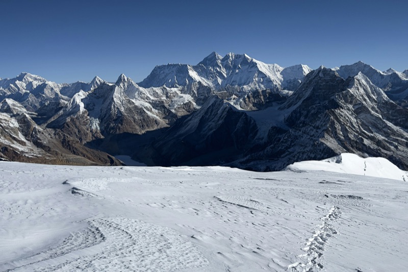
Nepal’s highest trekking peak, and the honest first 6,000er. A wild approach through the roadless Hinku valley, then a long glacier walk to a summit with five 8,000 m peaks on the horizon.
Know before you dream
- This is a climb, not a trek: crampons, ice axe, rope work on summit day. The skills are learnable at base camp; the altitude is not negotiable.
- Technically the gentlest of the big trekking peaks, but the highest: 6,476 m demands respect and real acclimatisation.
- The Hinku approach crosses the Zatrwa La at 4,600 m in the first days; the route acclimatises you by design.
- Summit day starts around 2 am: 8 to 10 hours on glacier, one steeper rope-length below the summit.
- Climbing permit through the national mountaineering association, arranged by the operating agency; insurance must cover climbing to 6,500 m.
Route
Highlights
- Everest, Lhotse, Makalu, Cho Oyu and Kangchenjunga from one summit
- The Hinku valley, days of forest and yak pasture without a road
- High camp at 5,800 m, sunset over an ocean of peaks
- Your first steps on a rope team, done properly
- A summit that converts trekkers into mountaineers
Gear and preparation
Full climbing kit over expedition trekking layers: double boots, crampons, harness, ice axe, jumar. Skills and kit guidance in Know the Mountain.
Questions
First climb ever?
Possible with strong trekking fitness and our pre-summit training days.
How cold on top?
−20 °C with wind at dawn is normal.
Mera or Island Peak first?
Mera for altitude with gentler ground, Island for steeper technique lower down.
Solo joiners?
Most of the rope team.
Groups form each season. Join the interest list and you’ll hear first.
Join the GroupMera Peak and Island Peak
Duration
21 days
Max altitude
6,476 m (Mera Peak)
Difficulty
Severe
Best season
Apr–May & Oct–Nov
Region
Khumbu & Hinku, Nepal
The journey
Altitude first, technique second. Mera’s high glacier summit out of the wild Hinku, over the Amphu Laptsa, then Island Peak’s headwall with three weeks of acclimatisation in your blood.
Know before you dream
- The classic pairing because the order teaches: Mera gives altitude on gentle ground, Island gives steepness with altitude already banked.
- The Amphu Laptsa between them is the journey’s technical heart: abseils and glacier camps at 5,800 m.
- Three weeks door to door; endurance and patience are the real prerequisites.
- Island’s summit-day success rate on this itinerary is the highest we see, and the reason is the route order.
- Two-valley permit stack; climbing insurance throughout.
Route
Highlights
- Mera’s summit horizon: Everest to Kangchenjunga in one sweep
- Crossing the Amphu Laptsa, the pass that makes it an expedition
- The headwall at dawn with a body already forged
- The Hinku’s roadless days
- Two summits, one story
Gear and preparation
Full climbing kit plus glacier-camping additions for the pass. Details in Know the Mountain.
Questions
Why not Island first?
Altitude tolerance is the scarcer resource; Mera builds it gentler.
The pass honestly?
The committing bit: abseils, exposure, cold camps. Trained for, not walked into.
First-timer possible?
With strong preparation and our training days, yes; it is the upper bound of first journeys.
Solo joiners?
Most of the rope team.
Groups form each season. Join the interest list and you’ll hear first.
Join the GroupCholatse
Duration
18 days
Max altitude
6,440 m (summit)
Difficulty
Severe
Best season
Apr–May & Oct–Nov
Region
Khumbu, Nepal
The journey
The beautiful problem. One of the Khumbu’s most striking mountains and one of its most genuinely technical permitted climbs: sustained ice and mixed ground where trekking peaks end and alpinism begins.
Know before you dream
- This is not a first summit and not a second. Cholatse asks for real alpine experience: sustained front-point ice, mixed rock sections, long exposure.
- The southwest ridge runs steep camps and technical ground for days, not hours.
- Small teams and honest self-assessment define who belongs here; we will say no, and mean it kindly.
- Weather windows shape everything; summit patience is part of the skill set.
- Expedition-class logistics: association permit, base camp infrastructure, insurance to 6,500 m with technical climbing cover.
Route
Highlights
- The north face profile that stops every trekker on the Cho La
- Ice pitches at 5,800 m with the whole Khumbu below
- A summit measured in hundreds per decade, not per season
- Taboche and Cholatse’s ridgeline against the sunset
- Climbing that earns the word
Gear and preparation
Full technical alpine kit: two tools, technical crampons, alpine rack familiarity. Serious list in Know the Mountain.
Questions
Minimum experience?
Multiple 6,000ers with fixed-line fluency, plus genuine ice technique.
How technical exactly?
Sustained sections of steep ice and mixed ground; this is alpinism.
Why offer it at all?
Because some of our community will grow into it, and honesty beats gatekeeping.
Small groups?
Very; ropes of two and three.
Groups form each season. Join the interest list and you’ll hear first.
Join the GroupChulu West
Duration
17 days
Max altitude
6,419 m (summit)
Difficulty
Severe
Best season
Apr–May & Oct–Nov
Region
Annapurna, Nepal
The journey
The Annapurna Circuit’s hidden summit. A detour from Manang into a high glacier basin, a snow ridge to 6,419 m, and the entire Annapurna range as the reward, before rejoining the circuit over the Thorong La.
Know before you dream
- The only major climb in our list that lives inside a classic trek: circuit acclimatisation, then the mountain.
- Technically moderate by 6,000er standards: glacier travel and a sustained snow ridge, fixed lines where the season demands.
- Camps above 5,300 m for several nights; cold management is a core skill here.
- Quieter than any Khumbu peak; some seasons the mountain is yours alone.
- ACAP plus association climbing permit; licensed guide and climbing insurance required.
Route
Highlights
- The Annapurna wall, Dhaulagiri and Manaslu from the summit
- A base camp valley the circuit crowds never see
- Snow-ridge climbing with the Manang desert below
- Finishing over the Thorong La like the circuit intends
- The Annapurna region’s most attainable real summit
Gear and preparation
Full climbing kit: double boots, crampons, harness, axe, plus deep-cold camping layers. Details in Know the Mountain.
Questions
Versus the Khumbu peaks?
Similar grade to Mera with more solitude and a built-in circuit.
First summit?
Feasible with strong preparation and training days.
Why fewer people?
No Everest in the view, which suits some of us fine.
Solo joiners?
Most of the rope team.
Groups form each season. Join the interest list and you’ll hear first.
Join the GroupPharchamo via Tashi Lapcha
Duration
16 days
Max altitude
6,187 m (summit)
Difficulty
Severe
Best season
Apr–May & Oct–Nov
Region
Rolwaling, Nepal
The journey
The wild one. Up the roadless Rolwaling valley beneath Gauri Shankar, over the glaciated Tashi Lapcha pass, and up Pharchamo’s snow pyramid, exiting into the Khumbu like climbers used to arrive.
Know before you dream
- Rolwaling is Nepal before the lodges: sparse villages, camping nights, genuine remoteness. Rescue here is measured in days.
- The Tashi Lapcha at 5,755 m is expedition ground in its own right: crevassed glacier, rockfall awareness, cold camps.
- Pharchamo rises straight from the pass: a sustained snow slope where the pass’s altitude becomes the summit’s springboard.
- This route asks for self-sufficiency of team and mind; the valley gives silence back.
- Restricted-area logistics for Rolwaling plus climbing permit; experienced guides mandatory in every sense.
Route
Highlights
- Gauri Shankar’s double summit over the valley for days
- Tsho Rolpa, the vast glacial lake beneath the pass
- The Tashi Lapcha itself, a door between two worlds
- Pharchamo’s clean snow pyramid from the col
- Descending into Thame as expeditions did for decades
Gear and preparation
Full expedition kit with glacier-camping depth; this route carries its own weight. Serious list in Know the Mountain.
Questions
How remote honestly?
The most committing route in our 6,000er list after the technical peaks.
Climbing grade?
Moderate snow; the seriousness is the setting, not the angle.
Why Rolwaling?
Because empty valleys are becoming the rarest terrain in the Himalaya.
Solo joiners?
The team is the safety system; it forms deliberately.
Groups form each season. Join the interest list and you’ll hear first.
Join the GroupDhampus Peak
Duration
12 days
Max altitude
6,012 m (summit)
Difficulty
Demanding
Best season
Apr–May & Oct–Nov
Region
Dhaulagiri region, Nepal
The journey
The gentle giant-viewer. A non-technical snow summit above the Kali Gandaki with one of the greatest viewpoints in Nepal: thirty named peaks, Dhaulagiri’s mass filling half the sky.
Know before you dream
- The most attainable summit in our list: glacier walking and a snow slope, crampons and rope more for safety than difficulty.
- Demanding rather than Severe, and the exception among our 6,000ers: a first summit in the honest sense.
- Altitude still rules: 6,012 m is earned through the approach’s acclimatisation, not talent.
- The Kali Gandaki approach threads the world’s deepest gorge; the journey outshines many harder climbs.
- ACAP plus climbing permit; licensed guide and climbing-rated insurance.
Route
Highlights
- Dhaulagiri at arm’s length, all 8,167 m of it
- Thirty summits named from one snow dome
- The Kali Gandaki gorge as the walk-in
- Yak pastures and Thakali villages of the approach
- A 6,000er summit that welcomes rather than tests
Gear and preparation
Entry climbing kit: boots, crampons, axe, harness for the rope. The full list in Know the Mountain.
Questions
Truly beginner-friendly?
The most, yes; fitness and acclimatisation still decide it.
Why Demanding not Severe?
No sustained technical ground; the grade tells the truth.
Best first 6,000er?
This or Mera, depending on whether views or altitude lead your ambition.
Solo joiners?
Most of the rope team.
Groups form each season. Join the interest list and you’ll hear first.
Join the GroupEverest Base Camp Trek
Duration
15 days
Max altitude
5,545 m
Difficulty
Demanding
Best season
Mar to May, Oct to Nov
Region
Everest, Nepal
The journey
The classic walk to the foot of the world’s highest mountain, up the Dudh Koshi valley through Sherpa villages, monasteries, and glacial moraine. No ropes, no technical ground: honest fitness and respect for altitude are the entry requirements.
Know before you dream
- Two acclimatisation days are non-negotiable. The route walks high and sleeps low.
- Nights above Lobuche reach −15 °C in season; days below Namche are often T-shirt warm.
- Train 8–12 weeks. The bar: consecutive 6-hour walking days with a light pack.
- No TIMS card here. The Khumbu uses its own municipality permit alongside the national park permit.
- Insurance with helicopter-evacuation cover is mandatory for this region.
Route
Highlights
- Sunrise from Kala Patthar with Everest, Nuptse and the Icefall in one frame
- Namche Bazaar, the Sherpa capital built into a mountainside amphitheatre
- An evening puja at Tengboche Monastery beneath Ama Dablam
- The memorial chortens at Thukla Pass, the trail’s quietest moment
- First sight of Everest from the ridge above Namche
Gear and preparation
A layered cold-weather system rated to −15 °C, broken-in boots, a 30–40L daypack, a sleeping bag with −10 °C comfort rating, trekking poles, and water treatment. Full gear guidance and altitude know-how live in Know the Mountain.
Questions
Do I need climbing experience?
None. It’s a trek: no ropes, no technical ground.
How fit is fit enough?
Comfortable walking 6 hours on consecutive days. Start training 8–12 weeks out.
What about altitude sickness?
We pace to prevent it and stay honest about symptoms. Descending is always the right call.
Can I join alone?
Most of the group does. That’s the point of a community expedition.
Groups form each season. Join the interest list and you’ll hear first.
Join the GroupEverest Three Passes
Duration
18 days
Max altitude
5,535 m
Difficulty
Severe
Best season
Mar–May & Oct–Nov
Region
Khumbu, Nepal
The journey
The complete Khumbu. One long horseshoe over the region’s three great passes, Kongma La, Cho La and Renjo La, linking Base Camp, the Gokyo lakes and valleys most EBC trekkers never see.
Know before you dream
- Three passes above 5,300 m in one route; this is the Khumbu’s toughest standard trek.
- Fitness for EBC is the entry point, not the finish line. Expect longer days and rougher ground.
- The Cho La crossing involves a small glacier section; microspikes earn their weight.
- Route runs clockwise or anticlockwise; clockwise (Kongma La first) acclimatises harder but earlier.
- Same permits as EBC: national park plus municipality, no TIMS.
Route
Highlights
- Sunrise on Gokyo Ri over the Ngozumpa glacier, Nepal’s longest
- Kongma La, the highest and quietest of the three
- Everest, Lhotse, Makalu and Cho Oyu in a single Renjo La frame
- Base Camp and Kala Patthar, earned the long way
- The turquoise Gokyo lakes at 4,700 m
Gear and preparation
EBC list plus microspikes, gaiters and a sleeping bag rated to −15 °C comfort. Full guidance in Know the Mountain.
Questions
Is it harder than EBC?
Substantially. Longer, higher, lonelier.
What experience do I need?
Strong trekking fitness; no climbing skills.
Which direction is better?
Clockwise for solitude, anticlockwise for gentler acclimatisation.
Can I join alone?
Most of the group comes alone.
Groups form each season. Join the interest list and you’ll hear first.
Join the GroupGokyo Lakes
Duration
12 days
Max altitude
5,357 m
Difficulty
Demanding
Best season
Mar–May & Oct–Nov
Region
Khumbu, Nepal
The journey
The Khumbu’s quieter masterpiece. Up the valley west of Everest to a chain of turquoise glacial lakes and a summit viewpoint many rate above Kala Patthar.
Know before you dream
- Quieter trails than the EBC route once past Namche; teahouses thinner on the ground.
- Gokyo Ri at dawn is a hard 2-hour climb; the reward is four 8,000 m peaks in one view.
- The lakes sit between 4,700 and 5,000 m; acclimatisation days are built in, not optional.
- Winter visits are possible but the lakes freeze and lodges thin out.
- Permits as for all Khumbu treks: national park plus municipality.
Route
Highlights
- The third lake at Gokyo village, impossibly turquoise
- Everest, Lhotse, Makalu and Cho Oyu from Gokyo Ri
- Walking beside the Ngozumpa glacier’s grey moraine sea
- Machhermo’s quiet stone-walled yak pastures
- A valley that still feels like the Khumbu of thirty years ago
Gear and preparation
Standard cold-season Khumbu kit; the EBC list covers it. Details in Know the Mountain.
Questions
Gokyo or EBC first?
Gokyo for views and quiet, EBC for the name. Many return for the other.
What is the fitness bar?
Six-hour days with one steep dawn climb.
Can it extend to EBC?
Yes, over the Cho La; that becomes the Three Passes’ middle third.
Joining solo?
Standard here.
Groups form each season. Join the interest list and you’ll hear first.
Join the GroupAnnapurna Circuit
Duration
13 days
Max altitude
5,416 m
Difficulty
Demanding
Best season
Mar–May & Oct–Nov
Region
Annapurna, Nepal
The journey
Nepal’s great crossing. From subtropical river valleys through Manang’s high desert to the prayer flags of Thorong La, then down into the ancient pilgrimage country of Mustang.
Know before you dream
- The route crosses from lush gorge to Tibetan-plateau landscape in a week; pack for every climate.
- Thorong La day starts around 4 am and climbs 900 m; it is the trek’s single serious test.
- Acclimatisation day in Manang (3,540 m) is non-negotiable.
- One permit is checked on the ground: the ACAP. Ignore outdated TIMS advice.
- Nepal requires a licensed guide for foreign trekkers in this region.
Route
Highlights
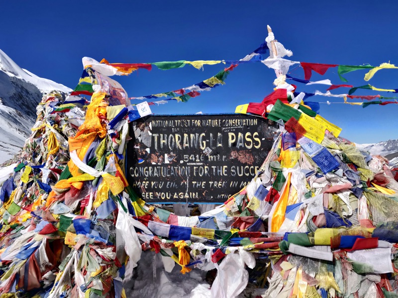
- Thorong La at 5,416 m, prayer flags against a huge sky
- The Manang valley, high desert beneath Annapurna III
- Muktinath, sacred to Hindus and Buddhists both
- Apple orchards and stone villages of lower Mustang
- Annapurna II catching first light from Upper Pisang
Gear and preparation
Four-season layering in one pack: warm-weather kit low, full cold-weather system for the pass. Guidance in Know the Mountain.
Questions
How hard is the pass day?
Eight to ten hours, pre-dawn start, honest cold. The rest of the route is gentler.
Are there roads on the route?
Partly; our staging keeps to trail wherever it exists.
Best month?
October for clarity, April for warmth.
Solo joiners?
Most of the group.
Groups form each season. Join the interest list and you’ll hear first.
Join the GroupAnnapurna Base Camp
Duration
9 days
Max altitude
4,130 m
Difficulty
Steady
Best season
Mar–May & Oct–Nov
Region
Annapurna, Nepal
The journey
A walk into an amphitheatre. Stone staircases through rhododendron forest and Gurung villages, ending inside a ring of 7,000 and 8,000 m walls.
Know before you dream
- Lower maximum altitude than the big treks, but the stone-step climbs are relentless; knees notice.
- The Sanctuary sits in avalanche country; season and recent snowfall shape the final approach.
- Spring paints the middle hills red with rhododendron.
- ACAP permit, checked at multiple points; licensed guide required.
- Cold at Base Camp surprises people: nights below −5 °C even in season.
Route
Highlights
- Dawn inside the Sanctuary, ringed by Annapurna I and Machhapuchhre
- The fishtail summit of Machhapuchhre, never climbed and never permitted
- Chhomrong’s endless stone staircase, the trek’s honest toll
- Gurung hospitality in Ghandruk
- Hot springs at Jhinu Danda on the walk out
Gear and preparation
Three-season kit with one genuine cold-weather layer for Sanctuary nights. Details in Know the Mountain.
Questions
Good first Himalayan trek?
One of the best.
Fitness bar?
Five to six hour days with big staircases.
Combine with Mardi Himal?
Yes, they share a trailhead region.
Altitude risk?
Lower than the big treks, but the last day still climbs fast; we pace it.
Groups form each season. Join the interest list and you’ll hear first.
Join the GroupMardi Himal
Duration
6 days
Max altitude
4,500 m
Difficulty
Steady
Best season
Mar–May & Oct–Nov
Region
Annapurna, Nepal
The journey
The short, sharp ridge walk. A forest trail out of Pokhara climbing a single spur to eye-level views of Machhapuchhre, all in under a week.
Know before you dream
- The whole route rides one ridgeline; weather moves fast and views come and go in minutes.
- Short does not mean soft: High Camp days climb steeply on rough trail.
- Lodges are simpler and smaller than the classic routes; book-ahead thinking applies in peak weeks.
- ACAP permit; licensed guide required.
- Ideal acclimatisation before a bigger objective, or a complete trek in its own right.
Route
Highlights
- Machhapuchhre close enough to read the snow flutings
- Sunrise from the upper viewpoint over the whole Annapurna wall
- Cloud-forest trail hung with moss and rhododendron
- Pokhara to trailhead in an hour; no internal flights
- The Himalaya’s best effort-to-view ratio
Gear and preparation
Light three-season kit with one warm layer for viewpoint dawns. Details in Know the Mountain.
Questions
Total beginner friendly?
Yes, with honest walking fitness.
How cold?
Viewpoint dawns around −5 °C in season.
Crowded?
Busier than it was, still far quieter than ABC.
Extendable?
Pairs naturally with ABC for a two-week Annapurna immersion.
Groups form each season. Join the interest list and you’ll hear first.
Join the GroupUpper Mustang
Duration
12 days
Max altitude
3,810 m
Difficulty
Steady
Best season
Mar–Nov, including monsoon
Region
Mustang, Nepal
The journey
A walk into a former kingdom. Behind the Annapurna–Dhaulagiri wall lies a high desert of cave monasteries, wind-carved cliffs and the walled city of Lo Manthang, closed to outsiders until 1992.
Know before you dream
- This is a restricted region. The permit is issued per day inside the zone and only through a registered agency, with a licensed guide.
- The rules changed in 2026: solo travellers can now obtain the permit, and pricing follows your actual days inside.
- Mustang sits in the rain shadow, so the monsoon months work here when the rest of Nepal is soaked.
- Altitude stays moderate but the wind is a daily character; afternoons blow hard and cold.
- Culture is the point: monasteries, festivals and villages ask for slower walking and open eyes.
Route
Highlights
- First sight of Lo Manthang’s whitewashed wall across the desert
- Cave monasteries painted eight centuries ago
- The Kali Gandaki gorge, deepest on Earth by some counts
- Tiji Festival in spring, three days of masked ritual
- A landscape closer to Tibet than to the Nepal of postcards
Gear and preparation
Three-season kit with serious wind protection and sun defence; this is desert trekking at altitude. Details in Know the Mountain.
Questions
Why is it restricted?
Border sensitivity and cultural preservation; the permit system keeps numbers low.
How hard is the walking?
Moderate days; wind and dryness are the real tests.
Best time?
May for Tiji, or the monsoon window when everywhere else drips.
Solo joiners?
Now possible under the 2026 rules; most of our group comes alone anyway.
Groups form each season. Join the interest list and you’ll hear first.
Join the GroupManaslu Circuit
Duration
14 days
Max altitude
5,106 m
Difficulty
Demanding
Best season
Mar–May & Oct–Nov
Region
Gorkha, Nepal
The journey
The connoisseur’s circuit. Around the world’s eighth-highest mountain through a valley that opened to outsiders only in 1991, ending over the snows of the Larkya La.
Know before you dream
- Restricted region: permit through a registered agency, licensed guide mandatory, priced per week inside the zone.
- The Larkya La day starts around 4 am and can carry snow and fixed-line sections late season.
- Villages here are culturally Tibetan; the trail doubles as a pilgrimage route.
- Teahouses are simpler than Annapurna’s; expect basic and honest.
- Three permits stack here: the restricted-area permit plus both conservation areas the route crosses.
Route
Highlights
- Manaslu’s double summit from Lho at first light
- The Larkya La at 5,106 m, the circuit’s earned crown
- Mani walls and monasteries of the Nubri valley
- Birendra glacial lake below Samagaon
- A circuit with a fraction of Annapurna’s foot traffic
Gear and preparation
Full cold-weather system for the pass; microspikes late season. Guidance in Know the Mountain.
Questions
Manaslu or Annapurna Circuit?
Manaslu for quiet and Tibetan culture, Annapurna for variety and comfort.
How hard is the pass?
Comparable to Thorong La with rougher ground.
Why the permits?
The region borders Tibet and stayed closed until 1991.
Solo joiners?
Permitted since 2026, guide required; our groups make it moot.
Groups form each season. Join the interest list and you’ll hear first.
Join the GroupManaslu Base Camp
Duration
10 days
Max altitude
4,750 m
Difficulty
Demanding
Best season
Mar–May & Oct–Nov
Region
Gorkha, Nepal
The journey
Up the Budhi Gandaki to Samagaon, then the steep pull to the base camp of the eighth-highest mountain, with the Nubri valley’s monasteries as the slow reward on the way.
Know before you dream
- Same restricted-region rules as the circuit: agency permit, licensed guide, per-week pricing.
- Base Camp day climbs over 1,200 m from Samagaon and returns the same way; it is the trek’s whole test in one morning.
- The route shares the circuit’s approach without crossing the Larkya La, so it suits tighter timelines.
- Expect basic teahouses and genuine remoteness; rescue here is slower than the famous valleys.
- Autumn brings expedition season; Base Camp becomes a working village of tents.
Route
Highlights
- Manaslu filling the sky above Birendra lake
- Pungyen Gompa, a monastery under the mountain’s east face
- Expedition base camp in season, prayer flags over glacier ice
- The Budhi Gandaki gorge, days of river-cut drama
- Sama Gaun’s stone lanes and yak trains
Gear and preparation
Cold-weather kit for the Base Camp push; the rest is standard three-season. Details in Know the Mountain.
Questions
Circuit or Base Camp?
The circuit for the full crossing, Base Camp for depth over distance.
Fitness bar?
One very big day; the rest are honest trekking days.
Can I see climbers?
In season, yes; Base Camp hums in September and April.
Solo joiners?
Same 2026 rules as the circuit.
Groups form each season. Join the interest list and you’ll hear first.
Join the GroupLangtang Valley
Duration
8 days
Max altitude
3,870 m (Kyanjin Gompa)
Difficulty
Steady
Best season
Mar–May & Oct–Nov
Region
Langtang, Nepal
The journey
The valley of glaciers, one long day’s drive from Kathmandu. Through forest and yak pasture to Kyanjin Gompa, ringed by 7,000 m ice, in the region that rebuilt itself after 2015.
Know before you dream
- Closest major trek to Kathmandu: no internal flights, one rough scenic drive.
- The 2015 earthquake destroyed Langtang village; walking here supports a community that rebuilt from nothing.
- Kyanjin Ri and Tserko Ri are optional dawn climbs; the valley walk itself stays gentler.
- National park permit required; licensed guide required.
- Cheese from the Kyanjin dairy is a genuine trail institution.
Route
Highlights
- Langtang Lirung’s icefall hanging over the valley
- Sunrise from Kyanjin Ri, glaciers on three sides
- The rebuilt Langtang village and its memorial
- Forest trails alive with langur monkeys
- Kyanjin Gompa’s dairy, cheese at 3,870 m
Gear and preparation
Standard three-season kit with one warm layer for the optional dawn climbs. Details in Know the Mountain.
Questions
Good first trek?
Yes, among Nepal’s best introductions.
How hard are the optional peaks?
Tserko Ri is a genuine 5 am, 1,100 m effort; entirely skippable.
Why Langtang over Annapurna?
Proximity, quiet, and the story of a valley that came back.
Solo joiners?
Most of the group.
Groups form each season. Join the interest list and you’ll hear first.
Join the GroupLadakh High Passes
Duration
8 days
Max altitude
5,260 m
Difficulty
Demanding
Best season
Jun–Sep
Region
Ladakh, India
The journey
The Markha valley crossing in India’s high-altitude desert: Buddhist villages, canyon trails and a finale over the Kongmaru La with Kang Yatse filling the horizon.
Know before you dream
- Ladakh runs on the opposite calendar: June to September, when the monsoon drowns Nepal, is the season here.
- Leh sits at 3,500 m; two acclimatisation days there before walking are part of the plan, not a luxury.
- Nights in village homestays replace teahouses; simpler, warmer, more personal.
- River crossings punctuate the route in early summer; sandals earn a place in the pack.
- Indian visa required; the trek itself crosses a national park with its own fees.
Route
Highlights
- Kongmaru La at 5,260 m, prayer flags over a desert of peaks
- Kang Yatse’s 6,400 m pyramid shadowing the upper valley
- Homestay evenings in Markha and Hankar
- Ancient forts and gompas rising from canyon walls
- The moonscape light Ladakh is famous for
Gear and preparation
Three-season kit with strong sun protection and cold-morning layers; desert nights bite. Details in Know the Mountain.
Questions
Why Ladakh?
A different Himalaya: drier, older-feeling, Buddhist to its bones, and in season when Nepal is not.
Fitness bar?
Six-hour days with one big pass; altitude arrives on day one at Leh.
Homestays really?
Yes, family homes with mattresses and dal; part of the point.
Solo joiners?
Most of the group.
Groups form each season. Join the interest list and you’ll hear first.
Join the GroupTour du Mont Blanc
Duration
11 days
Max altitude
2,537 m (Grand Col Ferret)
Difficulty
Steady
Best season
Jun–Sep
Region
France, Italy, Switzerland
The journey
The Alps’ great circle. Around the Mont Blanc massif through three countries, sleeping in mountain huts and valley villages, with the white summit turning above you the whole way round.
Know before you dream
- Altitude is modest; distance is not. Expect 10 to 15 km days with honest climbs, day after day.
- Huts book out months ahead in July and August; committing early is the whole game.
- No permits, no guides required by law; navigation is straightforward on Europe’s best-marked trail.
- Weather swings alpine-fast: snow on the cols is possible any month.
- Hut etiquette is its own culture: sheet liners, early lights-out, communal dinners.
Route
Highlights
- Crossing the Grand Col Ferret from Italy into Switzerland
- The Aiguilles above Chamonix at last light
- Refuge nights, dormitories full of a dozen languages
- Courmayeur’s Italian side, all granite and prosciutto
- The massif itself, never out of sight for a week
Gear and preparation
Light and fast: three-season layers, real rain shells, broken-in boots. No sleeping bag needed, huts provide blankets. Details in Know the Mountain.
Questions
Which direction?
Anticlockwise is classic; the crowds agree, which is its one flaw.
Camping possible?
Partly; hut-based is simpler and warmer.
Fitness bar?
Consecutive full days with 800 to 1,000 m of climb.
Solo joiners?
Most of the group.
Groups form each season. Join the interest list and you’ll hear first.
Join the GroupHaute Route, Chamonix to Zermatt
Duration
13 days
Max altitude
2,987 m (Col de Prafleuri)
Difficulty
Demanding
Best season
Jul–Sep
Region
France, Switzerland
The journey
Chamonix to Zermatt the walker’s way: a high traverse under the Alps’ greatest collection of 4,000 m peaks, from Mont Blanc’s shadow to the Matterhorn’s doorstep.
Know before you dream
- Harder than the TMB: higher cols, rougher ground, longer days between comforts.
- The season is short; before July snow blocks the passes, after mid-September huts close.
- Some stages carry ladders and fixed chains; a head for exposure helps.
- Route flexes daily with weather; good judgement matters more than pace here.
- Swiss hut prices sting; budget honestly.
Route
Highlights
- First full sight of the Matterhorn on the walk into Zermatt
- The Grand Combin filling the sky for three days
- Cabane de Prafleuri and the wild country around it
- Turquoise reservoirs and glacier snouts of the Val de Bagnes
- Europaweg’s balcony finish, a corridor of ice giants
Gear and preparation
TMB kit plus warmer layers and gloves for the high cols; poles near-essential on the moraine. Details in Know the Mountain.
Questions
TMB or Haute Route?
TMB to fall in love with the Alps, Haute Route to be tested by them.
Glacier travel?
The walker’s route avoids it; no rope needed.
Fitness bar?
Big consecutive days at TMB-plus intensity.
Solo joiners?
Most of the group.
Groups form each season. Join the interest list and you’ll hear first.
Join the GroupTorres del Paine Circuit
Duration
6 days
Max altitude
~900 m (Base Torres viewpoint)
Difficulty
Steady
Best season
Oct–Apr
Region
Patagonia, Chile
The journey
Patagonia’s W: three valleys stitched along the Paine massif’s southern face, granite towers at one end, the blue chaos of Grey Glacier at the other.
Know before you dream
- The seasons flip: October to April is the window, southern summer at its wildest.
- Altitude is trivial; wind is the mountain here. Gusts past 100 km/h are normal, not news.
- Every campsite and refugio requires advance reservation; the park turns away walkers without them.
- Weather delivers four seasons daily; the towers hide and reveal on their own schedule.
- The full O Circuit extends the W into an 8-day loop for those with the days.
Route
Highlights
- The three towers firing red at dawn from Base Torres
- Grey Glacier calving into its iceberg-strewn lake
- The Valle Francés amphitheatre in full roar
- Guanacos and condors against impossible skies
- Patagonian light, worth the airfare alone
Gear and preparation
Bombproof wind and rain shells over three-season layers; sun protection for the ozone-thin south. Details in Know the Mountain.
Questions
How windy really?
Enough to stagger you on passes; poles stop being optional.
W or O?
W for the essentials in six days, O for solitude and the Gardner pass.
Fitness bar?
Long distance days, 15 to 20 km, on good trail.
Solo joiners?
Most of the group.
Groups form each season. Join the interest list and you’ll hear first.
Join the GroupHuayhuash Circuit
Duration
11 days
Max altitude
~5,000 m (Punta Cuyoc)
Difficulty
Severe
Best season
May–Sep
Region
Cordillera Huayhuash, Peru
The journey
The Andes’ hardest classic. A full circle of a compact, savage range: eight passes above 4,600 m, turquoise lakes under 6,000 m faces, and the mountains of Touching the Void.
Know before you dream
- This is a camping expedition, not a teahouse trek; nights under canvas at 4,000 m plus for over a week.
- Eight high passes in eleven days; there are no easy days, only shorter hard ones.
- Communities along the route charge local fees per section; cash and patience both required.
- Remoteness is real: the nearest road is often days away, and rescue is slow.
- The dry season is austral winter: brilliant days, nights well below freezing.
Route
Highlights
- Siula Grande’s west face, the wall from Touching the Void
- The lake terrace at Carhuacocha, three giants mirrored at dawn
- Punta Cuyoc, the circuit’s 5,000 m high point
- Hot springs at Viconga, absurd and glorious mid-circuit
- A range you circle entirely in eleven days
Gear and preparation
Full expedition camping kit: four-season bag, insulated mat, down layers, altitude-ready everything. Details in Know the Mountain.
Questions
Hardest thing about it?
The accumulation: pass after pass with no recovery valley.
Prior experience?
At least one high-altitude trek; this is a poor first.
Why not the shorter mini-circuit?
It exists and it’s good; the full circle is the masterpiece.
Solo joiners?
Most of the group.
Groups form each season. Join the interest list and you’ll hear first.
Join the GroupKilimanjaro
Duration
7 days
Max altitude
5,895 m (Uhuru Peak)
Difficulty
Severe
Best season
Jan–Mar & Jun–Oct
Region
Tanzania
The journey
The roof of Africa on foot. Through five climate zones from rainforest to arctic summit ice, ending in the dark hours on the crater rim as the sun rises over the continent.
Know before you dream
- No technical climbing, but 5,895 m is serious altitude on a fast schedule; summit night is the hardest walking most people ever do.
- Park rules require a licensed operator with registered guides and crew; independent climbing is prohibited.
- Route choice shapes success: longer itineraries acclimatise better and summit more often.
- Summit night starts near midnight: 6 to 8 hours up in deep cold, then a very long descent.
- Respect for the crew culture matters; porters carry this mountain’s economy.
Route
Highlights
- Sunrise from Uhuru Peak, the ice fields glowing pink
- Walking from rainforest to glacier in five days
- The Barranco Wall, a scramble that looks worse than it is
- Camps above the cloud sea, Mount Meru floating on it
- Standing on the highest freestanding mountain on Earth
Gear and preparation
Full cold-weather summit kit over trekking layers: expedition gloves, insulated boots, headlamp with spare batteries. Details in Know the Mountain.
Questions
Success rate honestly?
Route and pacing dependent; longer routes summit far more often.
Coldest moment?
Summit night, −10 to −20 °C with wind.
Do I need climbing skills?
None; you need lungs, legs and stubbornness.
Solo joiners?
Most of the group.
Groups form each season. Join the interest list and you’ll hear first.
Join the Group